
Today, we are taking a tour of a great little loop within the town of Porthmadog - a serene and smooth stroll around the waters of the Afon Glaslyn and its tributaries. By Love Our Adventures standards, this is a short and easy walk, but it is ideal for people looking for something a little more accessible, or as an accompaniment to a long day shopping and enjoying the food options around Porthmadog. We loved it - a perfect addition to our day exploring around the town and the views you get make it so worth your time! Its quick, simple and beautiful - what's not to love?
This walk connects directly to Porthmadog town, so getting there shouldn't pose too much of a challenge. No matter which transportation option you take you will need to travel a small way in order to get to the start of the walk, but nothing too far, as both ends of the walk are a small ways out of the main town we will begin the walk from the bridge across the Afon Glaslyn at the top of the town. This start point happens to be very convenient for those driving as the primary car park for Porthmadog is right nearby, just off of the High Street and Down Madog Street, behind the large B&M store. From this car park, I recommend walking along the riverfront, past the B&M and store and out onto the road right at the bridge. For those coming via public transport, Porthmadog Train station is at the top of the High Street near Tesco and most busses follow the High Street and drop off somewhere along its stretch - so disembark your train or bus and follow the High Street past all the shops to reach the start. If you are coming from the high street (or if you have parked at the far end of the car park) then you may wish to follow the walk in reverse from what is mapped out above, following Snowdon Street until you cross a small bridge over the river and immediately turning off to join the path where it is clearly signposted.

From our start point on the bridge at the top of Porthmadog High Street, you'll want to follow the road out of town a little ways, following alongside the elevated train path towards the Premier Inn. I joined the path just beyond the Premier Inn, following the fence as it curved around before rejoining the top of Tan y Graig - you can also follow Tan y Graig directly up for a small shortcut, but ultimately the extra path bypasses walking in front of peoples homes, which I prefer to do if the option exists! From here the road will eventually reach a dead end alongside Ynys Tywyn Quarry, the quarry is carved into the small hillside, which does have walking routes marked on OS maps but was a little too overgrown on our visit to explore.
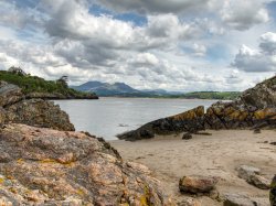
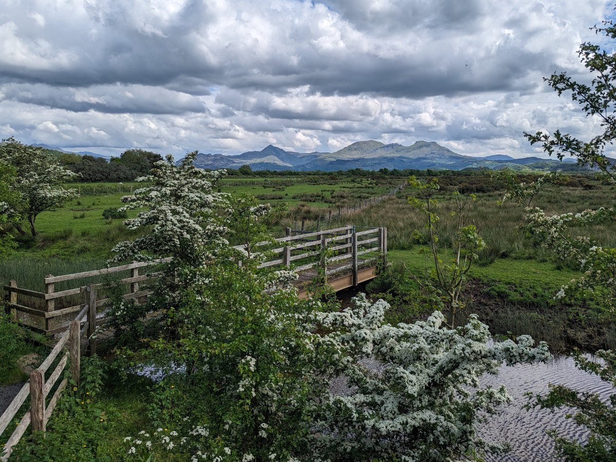
To begin on the little loop at Cob Crwn you have to pass over the relatively narrow, fenced-in bridge over the sluice gates - these gates help control water flow out of the estuary of the Afon Glaslyn and into the harbour after the cob (that is the long embankment the road and train line span, as opposed to our walk today which spans the "round cob") was created, blocking the natural path of the river. Once across the short bridge, the path opens up a bit again and you will officially be on the Cob Crwn, about a 1/3rd mile quarter circle loop around the tidal estuary that forms Llyn Bach with stunning views out the back towards the Snowdonia mountains beyond. There are a few information boards, as well as a handful of benches to enjoy the views from. The walk is perhaps best enjoyed by doing it twice, once at low tide and once at high tide to see just how much the landscape changes - you can even extend the walk here by travelling out into the fields, should you wish to, but expect the fields to be waterlogged and a little trickier going than the nice smooth pathways. There isn't too much to the walk other than to follow the paths and enjoy the moment - you can deviate around halfway down to get uninterrupted views of the mountains by following the stairs down to the bridge over the Afon Glaslyn tributary.


Before long the path will connect with the road at Snowdon Street as mentioned above, depending on your preferences you can follow this street back up into the town or double back on yourself, enjoy the views a second time and return to where you began! You can also cut through the waterfront path on the opposite side of the bridge on Snowdon Street, which brings you along the car park and back to the bridge where you began. I hope you enjoy this quick little walk in the heart of Porthmadog, if you've had a day around the shops and want something a little closer to nature then this is a great walk to tack onto the end. Alternatively, this is a great addition to a grander adventure around Porthmadog, including one of our favourites: the Moel y Gest climb to the astonishing views over the town (and lets you see the Cob Crwn loop from a very different perspective!). Or make this a quick escape to break up a long day's drive, pull up at Porthmadog car park and take in a quick loop in some lovely surroundings.